Travel Guide, Ha Giang Loop
Most Dangerous Part of Ha Giang Loop: Tips for Adventurers
The Ha Giang Loop is one of the most scenic and thrilling motorbike routes in Vietnam. Its dramatic landscapes and winding roads attract adventurers from all over the world. However, this beauty comes with risks. Some parts of the loop are particularly dangerous and require extra caution. In this guide, we’ll explore the most dangerous part of Ha Giang Loop and offer tips to help you navigate them safely.
Yen Minh to Dong Van: A Narrow and Winding Challenge
The journey from Yen Minh to Dong Van is one of the most treacherous sections of the Ha Giang Loop, demanding a high level of caution and skill from drivers. This 70-kilometer stretch is notorious for its narrow, winding roads that hug the sides of steep mountains, offering little room for error. With sheer drop-offs on one side and towering rock faces on the other, the slightest miscalculation can lead to severe consequences.
Road Conditions and Layout
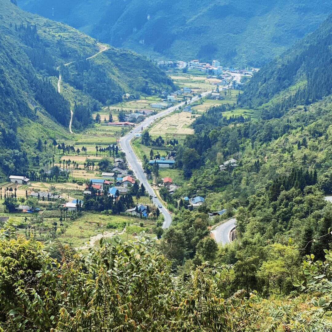
The roads in this section are extremely narrow, often just wide enough for one vehicle to pass safely. In many places, the asphalt is worn and uneven, adding to the difficulty of maintaining control. The frequent hairpin bends require drivers to navigate tight corners where visibility is limited, and oncoming traffic can appear suddenly. These sharp turns not only test driving skills but also the condition of your brakes and steering.
During the rainy season, the danger intensifies as the roads become slick and muddy. The region experiences heavy rainfall from May to September, leading to slippery surfaces that reduce traction. Potholes and loose gravel are common, making it easy to lose control of your vehicle. For motorcyclists, this can be particularly hazardous, as even a minor slip can result in a dangerous fall.
Weather and Visibility
Weather conditions can drastically affect the safety of this route. Fog is a frequent occurrence, especially in the early morning and late afternoon. Dense fog can reduce visibility to just a few meters, making it almost impossible to see the road ahead or any potential hazards. Rainstorms can also come on suddenly, further complicating the drive with poor visibility and slippery conditions. During these times, it is advisable to reduce speed and use headlights to improve visibility.
Landslide Risks
Another significant risk in this area is landslides. The mountainous terrain and heavy rainfall make the Yen Minh to Dong Van stretch prone to landslides, which can block roads and create dangerous driving conditions. In 2020, a series of landslides in the region resulted in road closures and severe delays, stranding travelers for hours. The local government has since made efforts to improve road stability, but the risk remains, especially during the rainy season. It is essential to stay updated on weather conditions and road status before embarking on this part of the journey.
Given these challenges, it’s crucial to take specific precautions:
- Maintain Your Vehicle: Ensure your brakes, tires, and steering are in top condition before setting out.
- Check Weather Reports: Avoid traveling during heavy rain or fog if possible.
- Travel in Groups: If you’re on a motorcycle, consider traveling with others for added safety and support.
- Stay Informed: Keep an eye on local news and updates about road conditions, especially regarding landslides.
Ma Pi Leng Pass: The High and Mighty Challenge
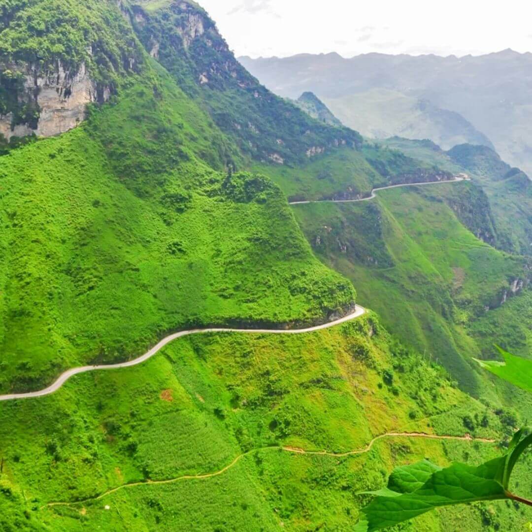
Ma Pi Leng Pass, often referred to as the “king” of Vietnam’s mountain passes, is a highlight of the Ha Giang Loop that attracts both awe and trepidation from travelers. This majestic pass, perched at an elevation of over 2,000 meters, offers some of the most stunning vistas in northern Vietnam. However, its breathtaking beauty is matched by its formidable challenges, making it one of the most dangerous sections of the loop.
Extreme Elevation and Altitude Sickness
Rising to over 2,000 meters, Ma Pi Leng Pass reaches an elevation that can affect travelers unaccustomed to high altitudes. The thin air at this height can cause altitude sickness, with symptoms such as headaches, dizziness, nausea, and shortness of breath. These symptoms can impair your ability to concentrate and drive safely. It’s important to recognize the signs of altitude sickness early and take necessary precautions, such as staying hydrated, taking breaks, and ascending gradually if possible.
Narrow Roads and Sharp Turns

The roads through Ma Pi Leng Pass are a true test of driving skill and nerve. They are extremely narrow, often barely wide enough for two vehicles to pass each other. The edges of the road drop off steeply, with little to no guardrails to prevent a fall. This lack of protection, combined with the sharp turns and steep inclines/declines, makes for a perilous drive. The constant need to navigate hairpin bends and blind corners requires full attention and precise control of your vehicle.
The tight switchbacks are particularly challenging for larger vehicles, which might need to maneuver back and forth to make the turns. Motorcyclists must be especially cautious, as the loose gravel and uneven surfaces can easily cause a skid or fall.
Sudden Weather Changes
Mountain weather is notoriously unpredictable, and Ma Pi Leng Pass is no exception. The weather can change abruptly, with clear skies giving way to thick fog, rain, or even snow in a matter of minutes. Fog is a common occurrence, significantly reducing visibility and making it difficult to see the road ahead. Rain can turn the already precarious roads into slippery traps, while snow, although rare, adds another layer of danger.
These sudden weather changes can be disorienting and hazardous, so it’s vital to be prepared for all conditions. Drivers should be ready to slow down or even stop if visibility becomes too poor.
Real-Life Experiences

Travelers who have experienced Ma Pi Leng Pass often speak of its beauty and danger in equal measure. Sarah, an adventure travel blogger, recounts her experience: “The views from Ma Pi Leng Pass are beyond spectacular, but the drive was one of the scariest I’ve ever done. The road was so narrow, and at times, I felt like I was driving on the edge of the world. When the fog rolled in, it was like driving blind. But reaching the top was worth every nerve-wracking moment.”
Tom, another traveler, shared his experience of the pass: “I encountered a sudden rainstorm while crossing Ma Pi Leng. The road became incredibly slippery, and the visibility dropped to almost nothing. It was a tense few hours, but taking it slow and steady got me through.”
Safety Tips
- Take It Slow: Speed is your enemy on these narrow, winding roads. Slow and steady driving is crucial.
- Be Prepared for Weather Changes: Carry rain gear, warm clothing, and be ready for sudden changes in weather.
- Use Your Horn: When approaching blind corners, use your horn to alert oncoming traffic of your presence.
- Travel in Daylight: Avoid traveling this pass at night when visibility is further reduced.
Climbing Up to Lung Cu Flag Tower: Steep and Slippery
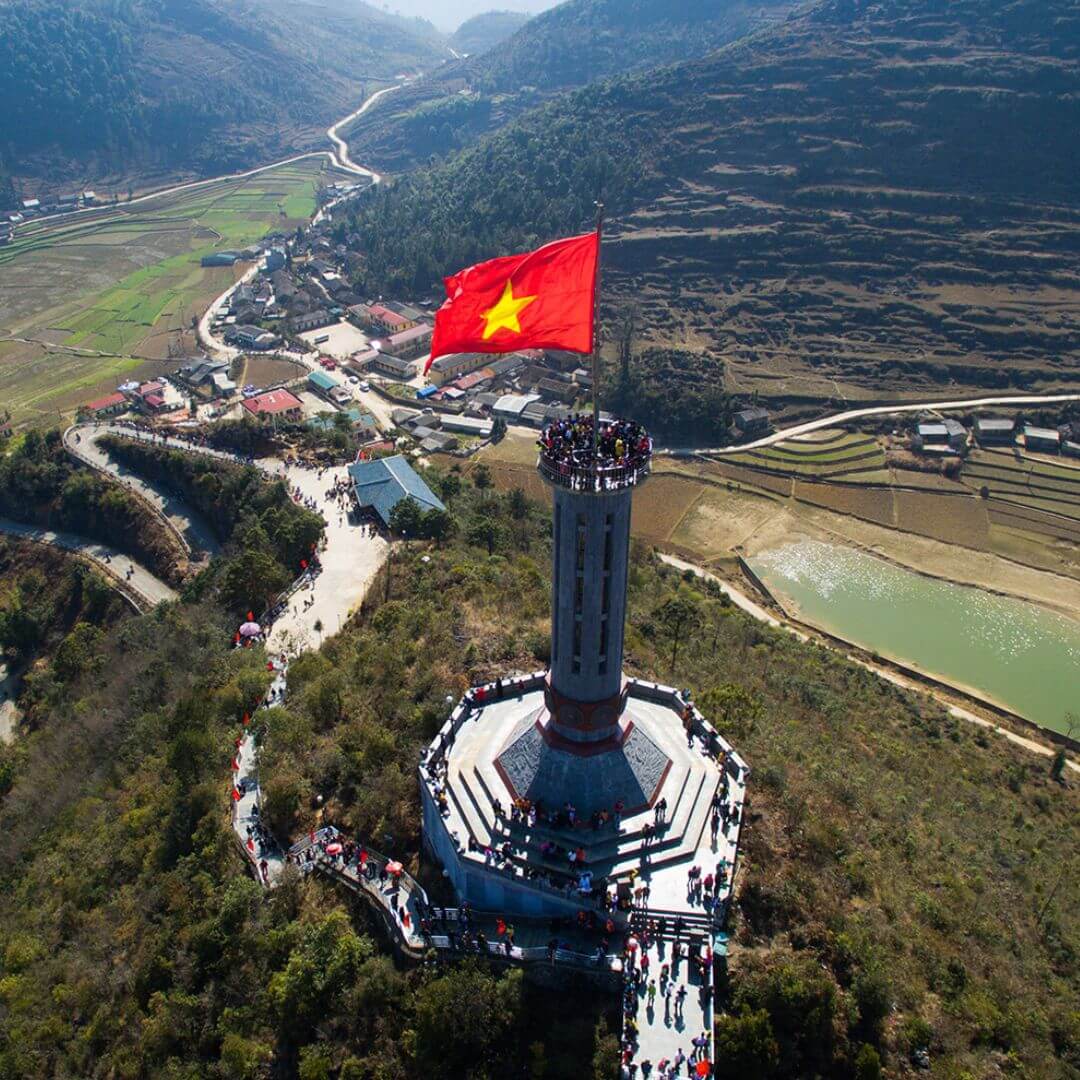
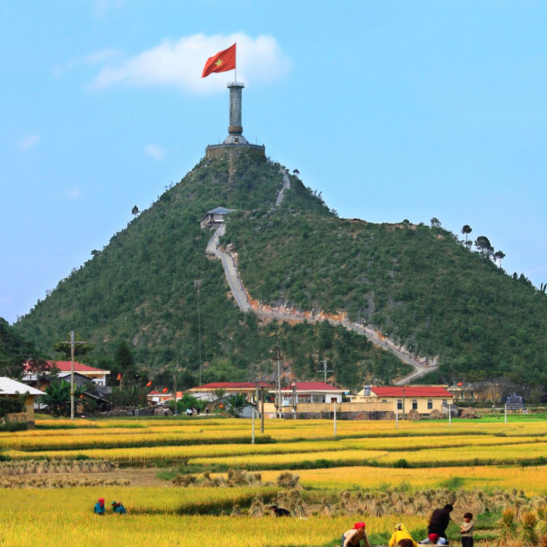
The ascent to Lung Cu Flag Tower, the northernmost point of Vietnam, is a journey that promises both a significant achievement and a substantial challenge. Situated near the Chinese border, the Lung Cu Flag Tower stands as a symbol of national pride. However, reaching this iconic landmark requires navigating a road that is as steep and difficult as it is rewarding. Here’s an in-depth look at what makes this part of the Ha Giang Loop particularly hazardous.
Steep and Difficult Roads
The road leading up to the Lung Cu Flag Tower is known for its steep inclines. As you climb higher, the road becomes progressively more challenging, requiring both physical endurance and driving skill. The steep gradients can be tough on vehicles, especially motorcycles, which might struggle with the continuous ascent. Drivers need to be adept at managing their speed and using lower gears to maintain control and power.
Loose and Slippery Surfaces
One of the most significant hazards of this ascent is the condition of the road surface. In many places, the surface is loose and covered with gravel, which can easily cause vehicles, especially motorcycles, to slip. During the rainy season, the road becomes even more treacherous. Mud and water can create slick conditions, making it difficult to maintain traction.
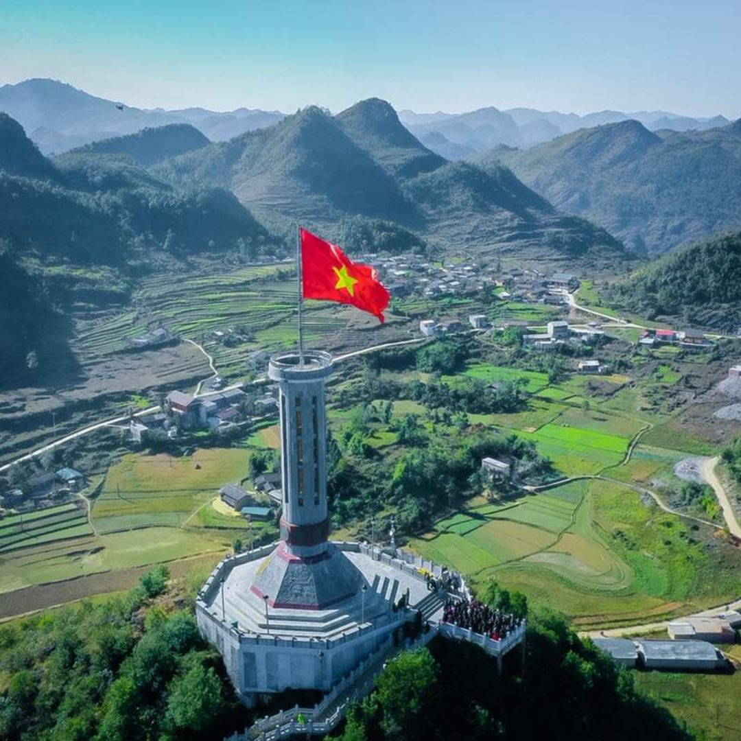
The combination of steep inclines and loose surfaces means that even a minor mistake can lead to a loss of control. It’s not uncommon for drivers to skid or slide, especially if they are not used to such conditions. Extra caution is required, and riders should be prepared for the possibility of having to dismount and push their bikes through particularly challenging sections.
Winding Nature of the Road
The road to Lung Cu Flag Tower is not just steep but also winding. The numerous curves and switchbacks add to the complexity of the drive, requiring constant attention and careful maneuvering. Each turn brings a new challenge, as the road can narrow unexpectedly or present sudden drops in elevation. The winding nature also means that visibility is often limited, making it difficult to see oncoming traffic or obstacles ahead.
For those on motorcycles, the frequent curves require precise handling and balance. Inexperienced riders may find the constant need to shift their weight and control the bike around tight corners quite demanding.
Altitude Challenges
As you climb towards the Lung Cu Flag Tower, the altitude also becomes a factor. The higher elevation can lead to thinner air, which can affect both the performance of your vehicle and your physical stamina. Symptoms of mild altitude sickness, such as shortness of breath and fatigue, can make the climb even more challenging. It’s important to pace yourself and take breaks to acclimatize.
To tackle the climb to Lung Cu Flag Tower safely, consider the following tips:
- Prepare Your Vehicle: Ensure your vehicle is in excellent condition, with good tires and reliable brakes. Motorcyclists should check their chains and gears.
- Check Weather Conditions: Avoid attempting the climb in heavy rain or immediately after a storm when the road is likely to be most slippery.
- Use Lower Gears: For vehicles, using lower gears can help manage the steep inclines more effectively.
- Travel with Others: If possible, travel with a group for added safety and support in case of difficulties.
Read More: Is the Ha Giang Loop Dangerous?
Most Dangerous Part of Ha Giang Loop FAQs
Why is the Yen Minh to Dong Van section considered dangerous?
This section is dangerous due to its very narrow and winding roads with steep drop-offs on the sides. The roads can become slippery and treacherous during rainy or foggy conditions, and landslides are a risk, especially during the rainy season.
What makes Ma Pi Leng Pass particularly hazardous?
Ma Pi Leng Pass is hazardous because of its extreme elevation, narrow roads, sharp turns, and steep inclines/declines. The risk of altitude sickness and sudden changes in weather and visibility also contribute to the danger.
What challenges does the climb to Lung Cu Flag Tower present?
The climb to Lung Cu Flag Tower is challenging due to the steep and difficult roads, loose and slippery surfaces, and the winding nature of the route. The altitude and road conditions require careful navigation and constant attention.
What should I do if I encounter bad weather on the loop?
If you encounter bad weather, such as heavy rain, fog, or sudden storms, it’s best to reduce your speed, turn on your headlights, and proceed with extreme caution. If visibility is too poor or the roads become too slippery, find a safe place to stop and wait for conditions to improve.
Conclusion
The Ha Giang Loop is a breathtaking adventure filled with both beauty and danger. Understanding the most dangerous part of Ha Giang Loop and taking the right precautions can make your journey safer and more enjoyable. With careful planning and respect for the road, you can experience all the wonders of this incredible route while staying safe.

